My first PCN ride in Singapore

I recently received my bicycle from France. Almost a month without riding my legs urged me to have a ride.
I needed to buy a few stuff for my bike, as I left some of my bike gear to a colleague in France. So I decided to have a ride to one of Singapore’s Decathlon stores. Then, let’s ride to the City Square Mall!
I basically had two options:
- Have a gentle ride using the PCN (Park Connectors Network)
- Rush to my destination via the main road
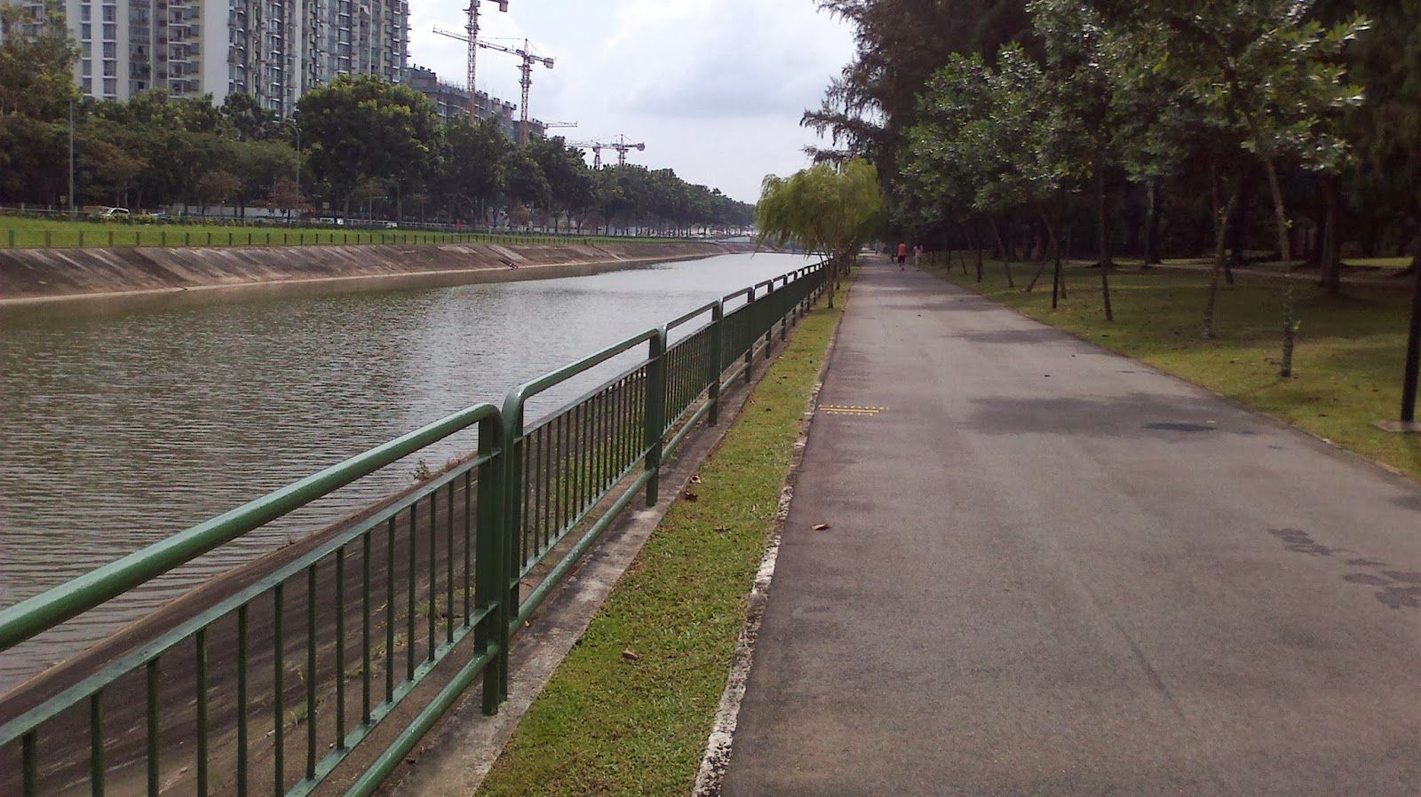
The PCN Ride
To go to City Square Mall I relied on my Garmin on which I just installed the Singapore Map thanks to the nice Dutch Garmin map export tool.
Generally, my GPS will make small detours if it can find a safer and more bicycle-friendly route. This, in my case, led me to mainly use the PCN as the GPS saw it as pretty nice, direct, dedicated, and connected routes. It indeed sounds like the perfect route.
I got lost at some point. Ok, that one is entirely my fault, I shouldn’t have thought I was more clever than the GPS.
Overall, this was a pleasant ride with almost no moments in which I had to share my path with cars. As you get to go through some parks (hence the name Park Connector) you experience nice greeneries.
Although I enjoyed my ride, there are a few things that I think are worth mentioning.
Works and deviation
There was some heavy work going on the Seragoon Park Connector. The good thing is that an alternate route was proposed to the cyclist and it was quite easy to follow. However as I traveled through the Deviation my GPS went berserk: “Calculating new Route…”, “Make U-turn”, “Turn left”.
When planning a route, you may not foresee these deviations. In my case the indications were easy to follow. I don’t know how it generally is.
Paths are mostly shared paths
Most of the paths are shared with pedestrians. The park connectors have dedicated paths and paths that are actually a sidewalk. The sidewalks are not the nicest as they are quite narrow and you get to encounter pedestrians and bus stops on them. During the weekend it can get quite crowded and you’d need to carefully overtake pedestrians while minding for the oncoming cyclists and pedestrians. I guess for a morning ride during the weekend this is much quieter.
A funny thing is that when I saw dedicated and segregated paths for cyclists and pedestrians, they kind of liked using the cycling path instead of the pedestrians.
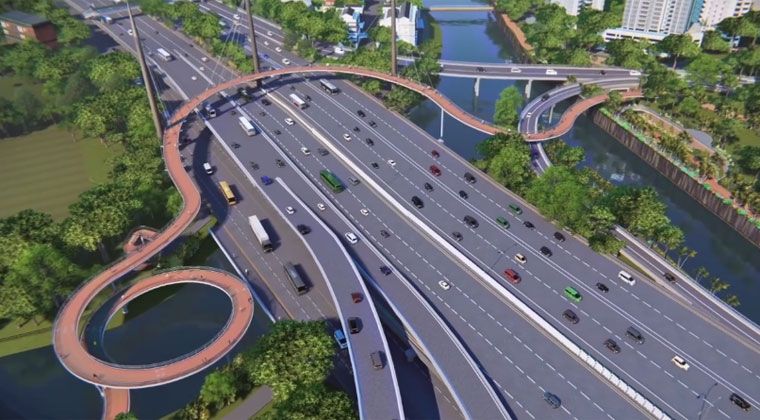
The dreaded overpass and underpass
You know the weather in Singapore is hot and humid. When you start riding you can enjoy a breeze of refreshing air. This is really enjoyable until you meet with an over or underpass on which you cannot physically ride (stairs) or on which you are not allowed to ride (or risk a S$1000 fine).
The thing is that you will start sweating even if you tried to pace yourself and having to carry the bicycle on the overpass makes things worst.
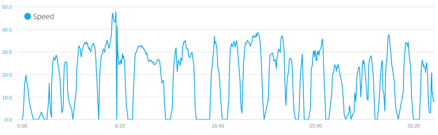
The overall trip from Buangkok to City Square mall took me 1h19m for a distance of 17.6km. It should have been quicker as I didn’t know the way. I think the ride could have been 10 minutes shorter without increasing my pace by… well… not getting lost.
The way back home
Even if I enjoyed my ride on the PCN the night fell and I wanted to go home faster. Also, I wanted to avoid the overpass and underpass I met before. I opened the map on my phone and decided to go for the most direct options, via the main roads. I used to ride long distances and in the traffic in Paris, I guess it shouldn’t be too bad.
I always keep going straight, I don’t use my GPS for navigation. I have quite a good pace, I ride around 30km/h which makes it easy to move in the traffic. I see the MRT stations on my way: Boon Keng, Potong Pasir, Serangoon… I am already at Serangoon that was quick!
Actually, I had more fun riding the way back. Probably because of the adrenaline. I like pushing myself and arrived completely sweaty at home. However, I didn’t really take the time to enjoy the scenery although I saw a few nice buildings on my way.
It took me 35 minutes to get home. Still longer than using the MRT, but 10 extra minutes for a decent workout and some fun is definitely worth it. Even though I was constantly riding around 30km/h, my average speed is only 18km/h.
Also on my way, I met a fellow cyclist. I couldn’t be helped, I had to speed in order to join him. I overtook him, then he overtook me again. We greeted each other at the traffic light and continued a bit together. That’s something I love about bikes, it triggers chats and exchanges with fellow riders. You definitely wouldn’t do that in a car or on the MRT: “Oh so you take the yellow line, me too, how awesome!”.
The presence of the bus lane made this ride quite enjoyable because you have to worry less about the traffic having to overtake you. There are much fewer buses to take care of than cars.
Conclusion
The PCN network is a very good idea and does wonders when they are made of dedicated and wide paths. However, a full ride away from the traffic is not always possible and sometimes makes big detours unavoidable.
If you are more in a hurry you can ride in the traffic on the main ride, most of them can be used by bike (exceptions being some tunnels and all the expressways). However, Singapore’s streets are wide with often fast-moving traffic which makes the experience to be quite intimidating. The good side is that you ride for sport there are good stretches of roads to practice.